| |
 |
The focus of the current joint project is located on the transfer of knowledge to Benin and Morocco. The IMPETUS project has carried out mono-disciplinary and interdisciplinary research projects between 2000 and 2009 in the catchment areas of the rivers Ouémé (Benin) and Drâa (Morocco). Besides, results were achieved thanks to a close co-operation with different institutions in both countries in the subject area of food security, hydrology, land use, society and health (see subjects Benin and subjects Morocco). On the base of these results, tools have been developed that can contribute to an efficient management of the limited natural resources, especially water resources.
What is being trained?
The knowledge that needs to be transferred, were collected during the three phases of the IMPETUS project and developed. They include an understanding of relevant natural and social processes for the water resources as well as the application of different models and specially developed "tools": IMPETUS Spatial Decision Support Systems, Information Systems and Monitoring Tools, as well as the database (IMPETUS Geonetwork) and the IMPETUS Atlases of Benin and Morocco. In addition, the support of the monitoring networks and laboratories that have been given during the handing over to co-operation partners will be conveyed in both river catchment areas.
Who is trained?
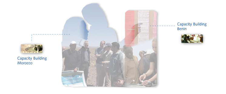
A total of ten to fifteen trainers selected from different levels of hierarchy in University and Administration of beninese and maroccan co-operation partner are trained. These trainers provide in the next steps for the knowledge transfer to an enlarged circle of participants from relevant institutions in their home countries. Besides, the Trainers promote the integration of the tools in different institutions. This ensures that even after the end of the joint project, the knowledge about the project results and tools is still available in Benin and Morocco.
How ist the training?
During the third Phase of IMPETUS projects took place trainings in the form of basic courses and workshops on the topics of GIS, remote sensing, spreadsheets, modelling and data exchange as well as workshops for the introduction of each tools with numbers of participants between 5 and 30. Special workshops are topically carried out for the trainers to separate SDSS, to enlargement of the atlases and to Geonetwork with exercises as block events in Germany and both partner countries. Thereby, it remains enough time also for discussions about the best form of teaching the contents. Together with trainers, approaches for the transfer of knowledge to a wider circle of participants are compiled. An offer of e-learning is under construction – for technical reasons only for Morocco – and will, in co-operation with a Moroccan university.
|
|